st-1 color-1-full, sb-1 color-1-top, st-2, sb-2 color-1-bottom, st-3 color-1-full


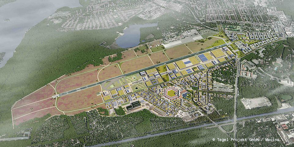
Tegel project
An airport is closing. A new urban district is being created.
Following the closure of Berlin-Tegel, the site will be developed into Urban Tech Republic Berlin TXL and Schumacher Quartier. Tegel Projekt GmbH is managing the transformation on behalf of the State of Berlin.
Starting position
A complex planning environment is being created for the development of the former Berlin-Tegel airport site. Different areas of expertise, roles and tasks are intertwined. Digital applications should support these processes in the future. This initially lacked a common understanding of users, usage contexts and data requirements.
Approach and solution
UseTree accompanied the Tegel Project GmbH with a structured series of workshops for requirements analysis. The focus was on real usage situations and specific tasks. User roles, use cases and data requirements were developed, prioritized and related together.
The result is a clearly structured requirement base for a geospatial data infrastructure. It describes relevant usage scenarios, prioritized use cases and central data requirements and serves as a basis for further planning steps.
Impact
The requirements analysis creates clarity and common orientation across specialist areas. It enables well-founded decisions and forms a reliable basis for the digital development of the Tegel project.
Impact
The requirements analysis creates clarity and common orientation across specialist areas. It enables well-founded decisions and forms a reliable basis for the digital development of the Tegel project.
Impact
The requirements analysis creates clarity and common orientation across specialist areas. It enables well-founded decisions and forms a reliable basis for the digital development of the Tegel project.


%201.png)
Lorem ipsum dolor sit amet, consectetur adipiscing elit. Suspend Varius Enim in Eros Elementum Tristique. Duis cursus, mi quis viverra ornare, eros dolor interdum nulla, ut commodo diam libero vitae erat.
Lorem Ipsum Dolor Sit Amet